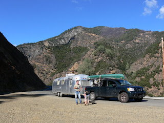
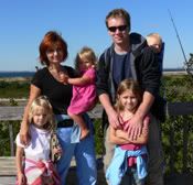
 When we choose not to go on highways, we know that sometimes there might be extra challenges on the way (like we don't have enough of challenges!). Watching for very infrequent gas stations and hoping there would be one before we run out of gas, is one example. At that point it doesn't matter how much gas costs. Making sure we have enough food and water in case we'll end up pulling over into the woods for the night, is another example. Making sure everybody is happy and cheerful while traveling, is another example. And I can go on , and on, and on.
But when we encountered new challenges of going through high elevations, it added extra strain to our nerves and became a test we had to pass with flying colors, whether we wanted it or not.
Being a designated navigator, I usually study the maps and by now have developed an eye for predicting where it would be a lot of going up or winding left and right. If there are a lot of high peaks noted on the map, that's a sure sign the road will be far from being a piece of cake!
When we decided to take the road leading to Shasta State Forest to old California towns of the gold rush era, the anticipation of breathtaking landscapes was exciting.
We went up 2,100 feet above the sea level. Then the road took us 1,000 feet down. Then, in a short while, another 1,800 feet up. No overheated engine. YET.
Driving along River Trinity, I was just seeing the miners digging for gold and sifting the rocks in the cold water, freezing their fingers but warming their spirits with hopes of finally striking a jack pot. The smell of gold was in the air!
 With the speed we were climbing those steep summits the morning plan of making it to Redding had to be ditched. A new plan was to keep an eye on the engine not to let it overheat and then find a place to spend the night.
We passed French Gulch, a charming village, once a colorful mining town and still an active community with a small hotel, store and a church, has remained unchanged, a living relic of the last century that has been added to the National Register of Historic Places.
When we were heading towards Weaverville, the center of the states northern gold-mining era, and the Oregon Pass (a stretch of the road with elevation of 2,888 feet on top of other thousands of feet above the sea level already) we almost ended up camping out on the side of the road.
Three times the gauge climbed very close to "hot", and we both decided that we'd better take the highway next time. Despite the stress I was still trying to enjoy stunning views that were full of undescribable charm.
With help of binoculars I spotted a temple all the way up on the pick of a high mountain. Later I read that it was built in 1874 by the Chinese who came to work in the mines. It now displays priceless tapestries, carvings and other works of art.
 The time was way after 6 pm, and being overly exhausted after the steep ride up and then 8% downhill grade ( a few times throughout the day), we started looking for a campground.
A sign showed us to make a left turn down the road. We kept on driving for a few miles with no campground in sight. The road was getting more and more winding and turned into a one lane gravel road. It looked like we'd have to make a U turn, and so we started looking for a wider driveway (there were a few houses along the road) and got ready to knock on the door and ask for permission to make a turn. Private property, no trespassing.
I noticed somebody looking out from the window and Mirek jumped out to ask.
"Keep on going. This road ends at the campground. I stumbled upon it 30 years ago, then moved into the area, built this house and raised my family here. You are going good. The campground is straight ahead," a good Samaritan gave us the words we so wanted to hear.
 We were "home" for the night.

0 comments:
Post a Comment